
If you are reading this, you are probably somewhere between excited and mildly terrified about what the full day of ascent on Mount Kinabalu (Day 1) actually looks like. I was too. This is everything I wish someone had told me — what you will see and what to expect at each stage from the morning admin to the trail sections, all the way to falling asleep at base camp with your alarm set for 1:30am. We went the DIY route, so the morning registration details may not apply if you have booked through a tour.
See: The Ultimate Guide to DIY your Mount Kinabalu Trek under S$500
Table of Contents
⇾ The Morning — Park Office Registration and Shuttle to Timpohon Gate
⇾ Into the Forest — Timpohon Gate to Pondok Kandis (0-1km)
⇾ Finding your Rhythm — Pondok Ubah to Pondok Lowii (1-2.5km)
⇾ The 2,500m Wall — Pondok Mempening to Layang-Layang (2.5-4km)
⇾ Above the Treeline — Layang-Layang to Pondok Villosa (4-5km)
⇾ The Final Stretch — Pondok Paka to Panalaban Basecamp (5-6km)
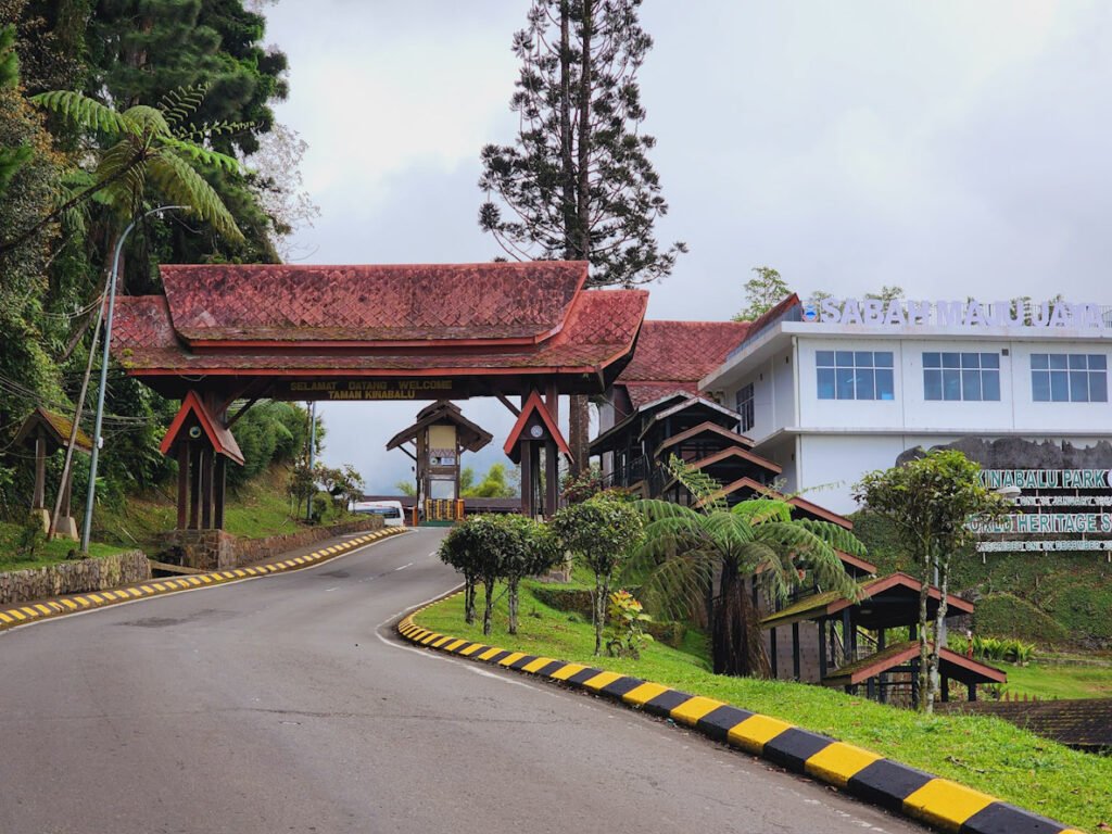
The Morning — Park Office Registration and Shuttle to Timpohon Gate
We based ourselves in Kundasang for 2 days before the climb to acclimatise and explore the area. On climb day, we were up and moving by 7am. A minivan came to pick us up for a 10min drive to Kinabalu Park Office – arranged with our hotel the night before at MYR 84 in total, it will make 2 trips to transport 12 of us and our bags. As our hotel did not serve breakfast, the plan was to register first and eat after. We arrived at the park around 7:15am, paid the conservation fee at the entrance security post (MYR 50 for foreigners, MYR 10 for Malaysians) and headed to Sutera Sanctuary located next to the main office to deposit bags that we will not need for the climb. MYR 12 per bag, quick and easy.
The counter staff at the park office was not very well-versed in English so we relied on our Malaysian friends which made the process noticeably smoother. Passports were handed over for photocopying and we paid a small charge of MYR 8, including the additional admin required for 2 of our mates who just renewed their passports. Once we had our particulars confirmed, the staff went to notify the guides office and climbing passes were issued. The pass is to stay on and visible at all times on trek. Do not lose it.
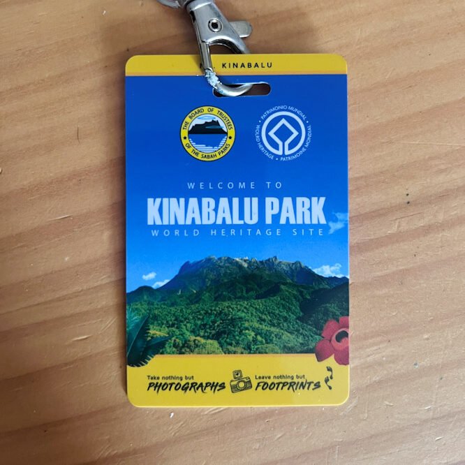
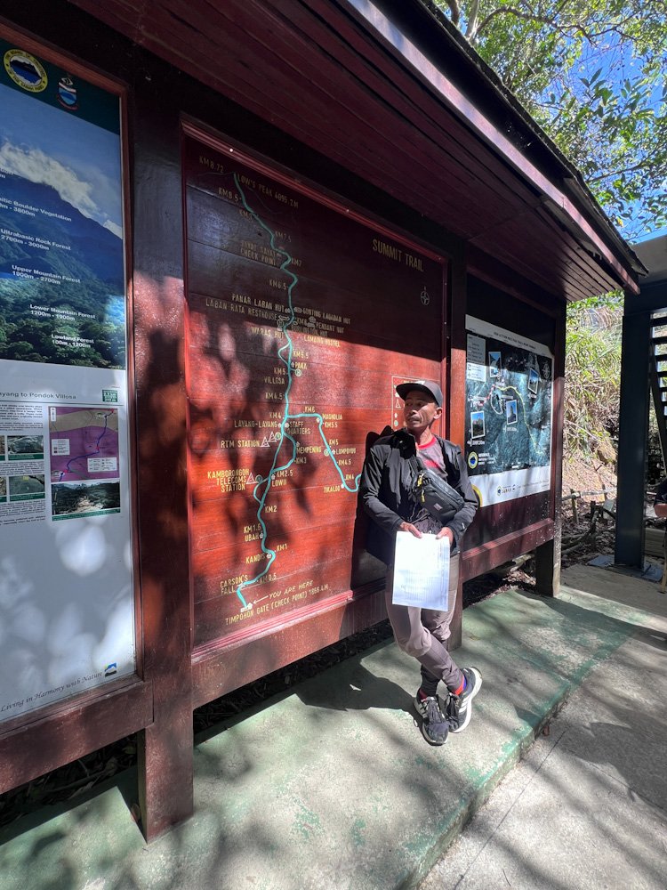
Our head guide, Hariz, appeared shortly after and took over. He sorted the guide assignments – 1 guide to every 5 climbers, so 3 for our 12 – then called the porters over to weigh bags. Porter fee is MYR 14 per kg, round trip. One important thing to note: porters hike directly to base camp so whatever you need on the trail — water, food, rain jacket, first-aid, poles etc, should stay with you in your daypack. Few of us also rented trekking poles at MYR 10 per pole. Everything was sorted and paid in cash to Hariz – guides, porter, poles, and the shuttle to Timpohon Gate (MYR 10 per person, round trip). From baggage deposit to registration, guide assignment, porter weighing and payment, the entire was efficiently wrapped up in under 40min for 12 of us.
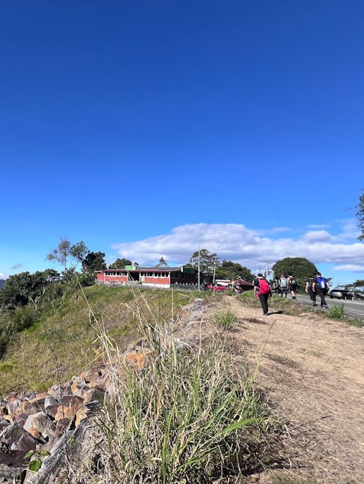
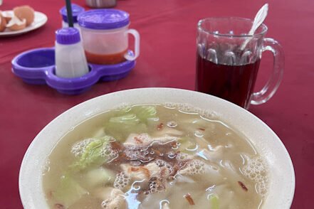
We were out for breakfast by around 8am, heading towards a standalone local restaurant just across the highway from the park office. Tahubang Restaurant is the kind of place that has been feeding trekkers for years and knows exactly what they need. They serve local and western food like noodles, rice, toasts, sausages, kopi, teh etc. Food is around MYR 10-12 and drinks MYR 3–5. You can pack lunch here if you have not sorted it in advance – DIY climbers are to bring their own lunch on trail. On a clear morning, the peak is visible from the front of the restaurant, framed above the park office rooftop. We took a group photo here. Good omen.
Back at the park by 9:30am, the shuttle filled up and we were off. It took about 15-20min to drive up to Timpohon Gate (1,866m). Hariz then introduced us to our other 2 guides, Iging (70 years old!) and Dolius (turned out to be also our porter) and began running through the route. He highlighted the one thing everyone would remember – at 2.5km, you will get tired as you start feeling the elevation. He said it like he had said it a thousand times. He was right.
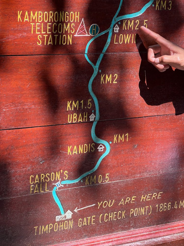
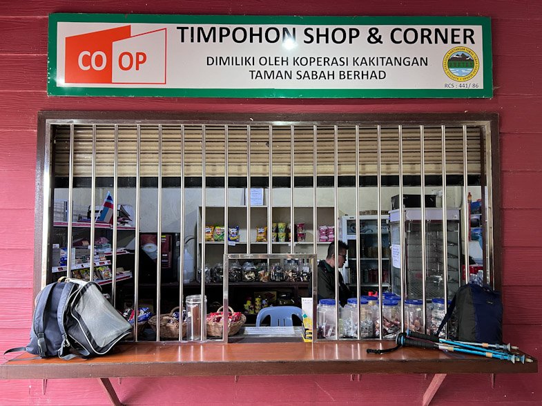
At the gate you will walk through a checkpoint on the right to flash your climb pass and a small Timpohon Shop on the left selling drinks, snacks, and basic supplies. 9 of us had not packed lunch and we were lucky that day — the store had stock and someone was available to make it so they prepared fried noodles in their makeshift kitchen and packed it for us at MYR 10 each. This took a while and pushed our trail start to 10:15am. Toilet break, final checks and we were on the trail. We were probably the last group to set off that day with the cut-off being 10:30am. Pack your lunch. Do not rely on the gate store.
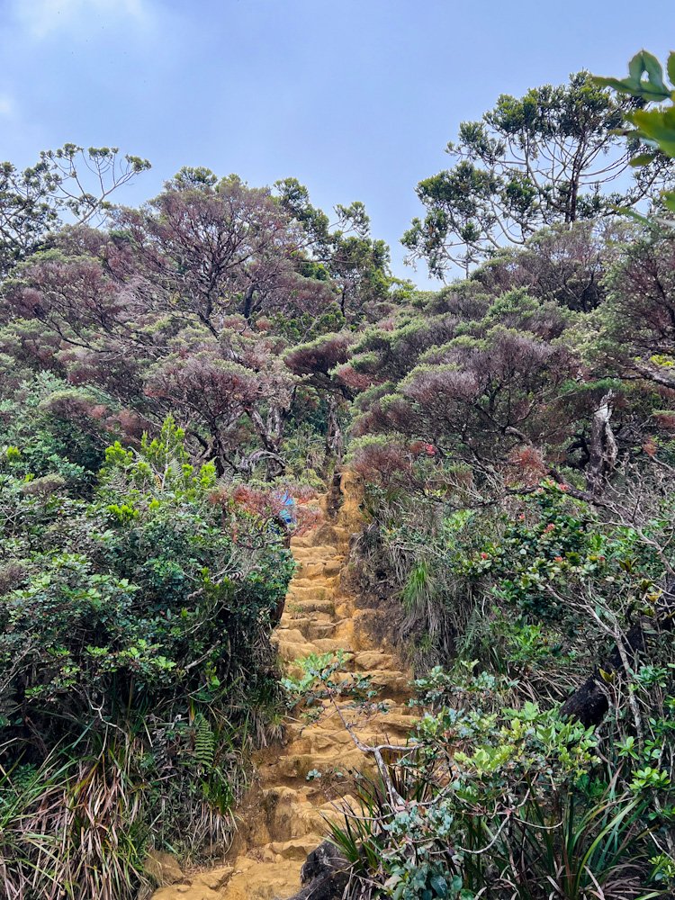
Into the Forest — Timpohon Gate to Pondok Kandis (0–1km)
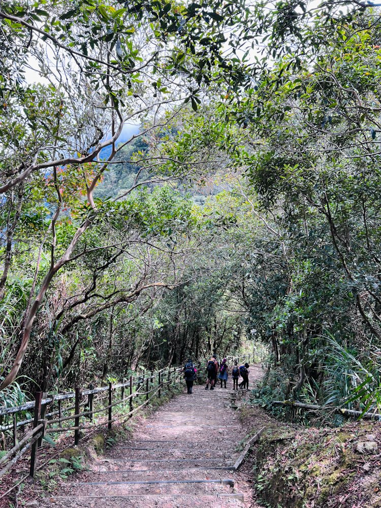
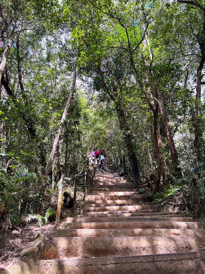
The first thing you notice stepping onto the trail is the air. Cooler, cleaner, it makes you want to breathe deeper. Wooden steps lead you down into the dense tropical rainforest as the trail actually descends briefly before the real work begins. We were in mid-April and the temperature was a comfortable 17–20°C here. It was also the dry season so Carson’s Waterfall at the base of the descent lay quiet and was easy to miss.
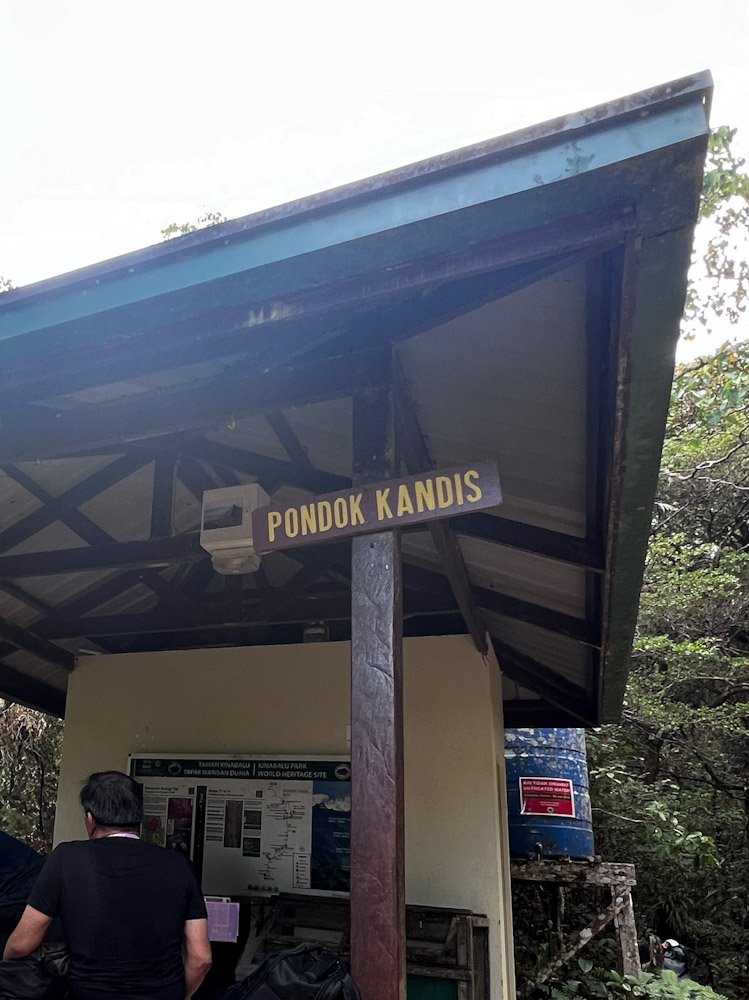
The first rest hut, Pondok Kandis, appears after a series of continuous wooden steps up just before the 1km (2,039m) mark. We reached it roughly 15min in and were not tired yet but stopped anyway to let the group settle into pace. To our pleasant surprise, there is a basic dry squat toilet here and at every hut after.
Finding your Rhythm — Pondok Ubah to Pondok Lowii (1–2.5km)
Pondok Ubah comes quickly, less than 500m from Kandis. We passed through at around 11:25am (1 hour from start of trail). Short break, move on. Past the 1.5km (2,164m) marker, the forest opens up briefly and the canopy pulls back to reveal the landscape of Sabah spreading out beneath you. This lasts a few minutes before the forest closes back in, but it is your first glimpse of how high you already are.
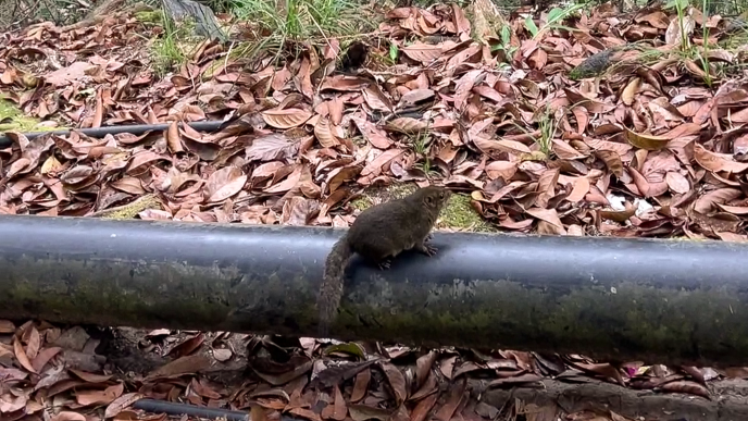
By Pondok Lowii at around the 2km (2,252m) mark, a few in our group were starting to feel the first real fatigue. We took a proper break here, circulating chocolate, nuts, biscuits, water. This was also where the squirrels found us. Completely unafraid, clearly very experienced with trekkers, these Bornean Mountain Squirrels worked the crowd with impressive confidence. One in particular – exceptionally chubby, determined and entirely unashamed – kept circling back long after the others had moved on. If you have nuts, prepare to make a friend.
The 2,500m Wall — Pondok Mempening to Layang-Layang (2.5–4km)
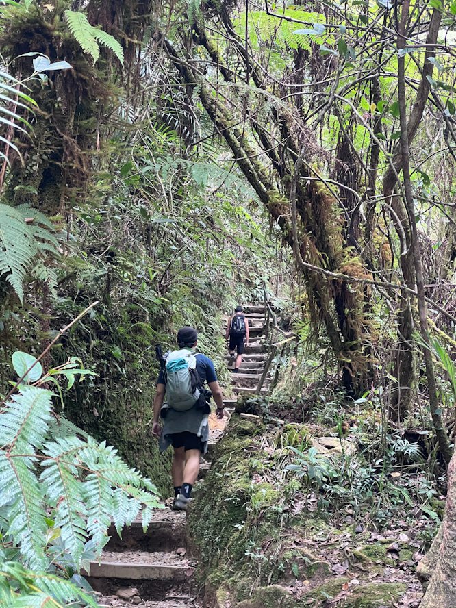
The trail continues upward on consistent stone steps and steady incline. We passed Pondok Mempening at around 12:20pm. Just as we approached the 2.5km (2,350m) marker, it happened. The legs got heavier and the breathing harder. Our guide had called it exactly. The air up here is doing less work for you than it was an hour ago. We slowed our pace to allow our body to adjust. Within 20min, it felt better. Keep moving at whatever pace feels sustainable. Pushing through is not the answer, but neither is stopping.
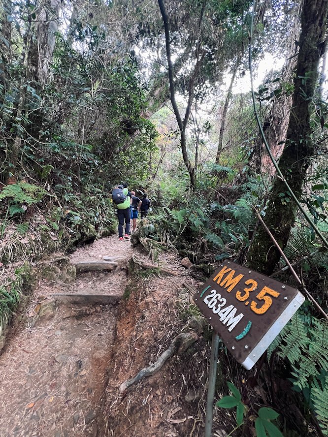
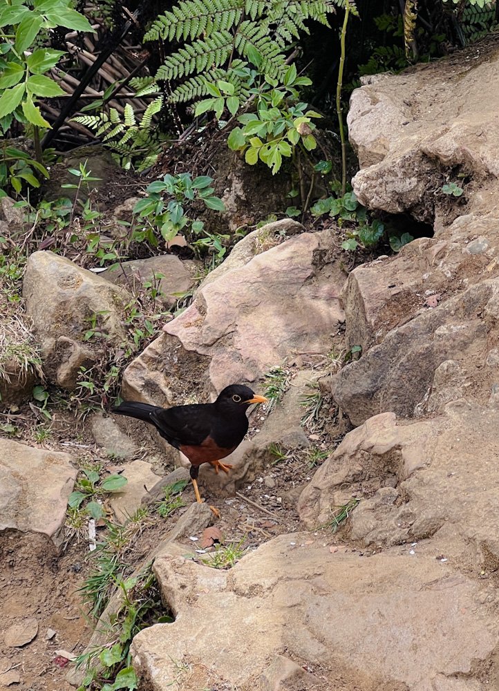
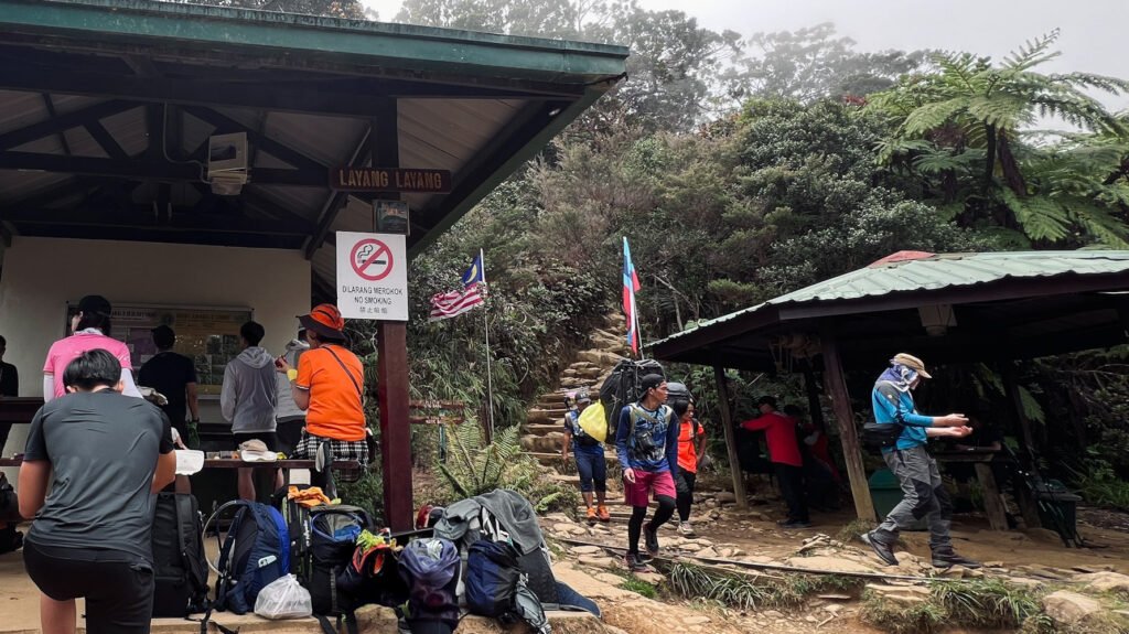
After passing 3.5km (2,634m), you reach Layang-Layang,the biggest rest stop on the trail with two shelters and a small quarters used by porters and park staff. We arrived at around 12:45pm and stopped for a much-needed break. Like most trekkers, we also made this our lunch stop. A curious Kinabalu Island Thrush popped by here and joined us for a bit. At 2,702m, the air carries a real chill when the wind picks up. Your body cools down faster than you expect once you are no longer generating heat from the climb. This is where I pulled on my jacket for the first time. One of our friends started getting thigh cramps here despite a litre of 100plus and a salt tablet. It was manageable at first but persistent, slowing our pace from Layang-Layang onwards in intervals. Stretch, keep warm, and do not let your body cool down too much to reduce risk of cramps.
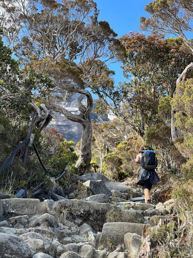
Above the Treeline — Layang-Layang to Pondok Villosa (4–5km)
Past the 4km (2,745m) mark the mountain changes its character. The dense forest gives way to higher subalpine terrain where the trees are shorter and more sparse and the air noticeably cooler. The ground changes to more yellowish ultrabasic and the steps get slightly steeper. Another member of our group started showing early signs of potential cramping here so we built in more frequent stops to hydrate and stretch. As you approach 3,000m, the reduced oxygen efficiency means your muscles work harder for the same effort even if you are not feeling the effects of altitude sickness. Nobody in our group experienced AMS which we were grateful for. On hindsight, the extra stops the cramp episodes forced on us probably helped.
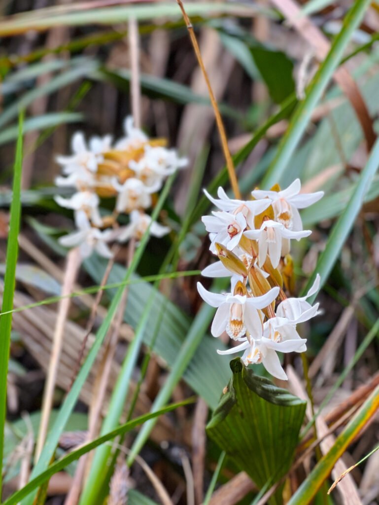
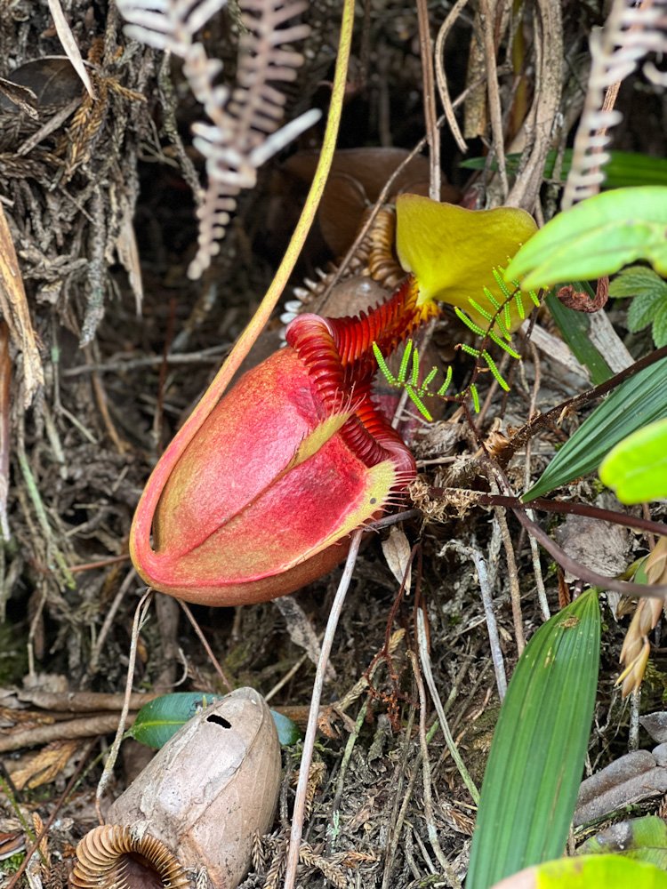
With better pacing and more time to look around, this was also where we caught the iconic flora of Mount Kinabalu we might otherwise have walked straight past. Just after 4.5km (2,898m), we spotted some pitcher plants tucked quietly among the moss and roots. And a little further, wild white orchids. By the time we got to Pondok Villosa, the weather had started to cloud over. The stops also started to feel colder faster so we kept our break short, just enough to stretch and move on.
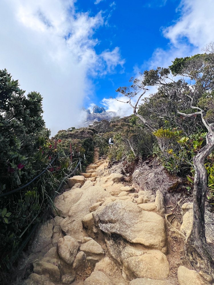
The Final Stretch — Pondok Paka to Panalaban Basecamp (5-6km)
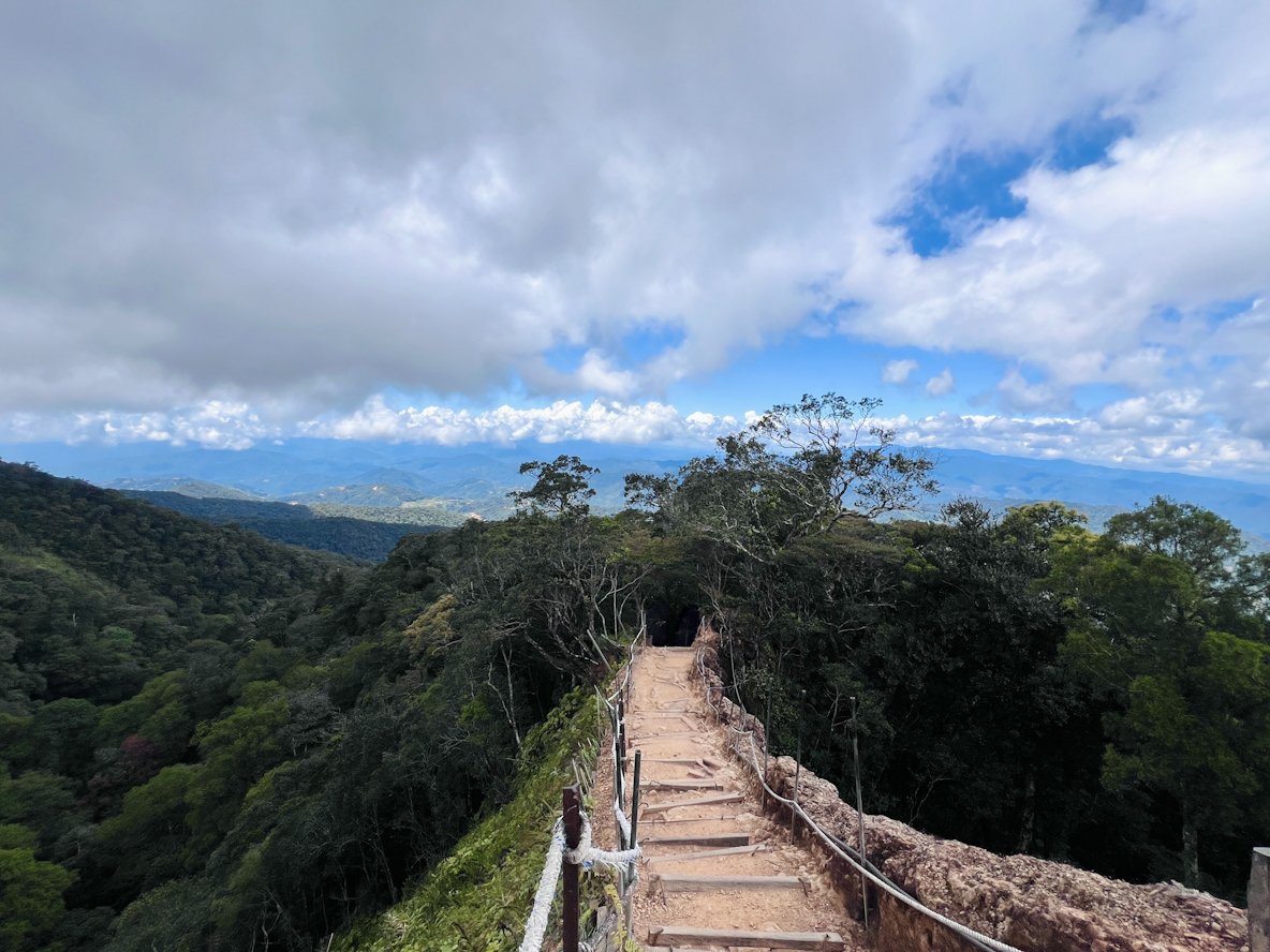
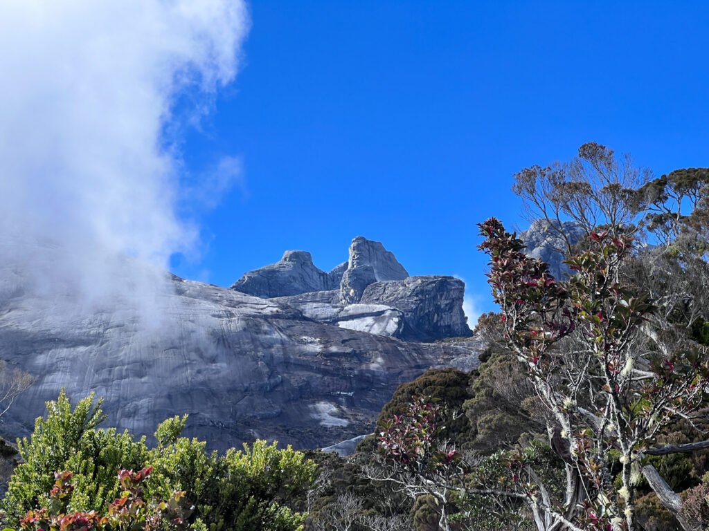
This is my favourite section of the entire ascent. The trail gradually transitions to steeper, rocky steps and the dramatic granite peaks begin to appear between the trees and shrubs, with clouds drifting at eye level. Pondok Paka came after the 5km (3,001m) mark. It is the last rest stop before Panalaban Base Camp. The shelter was named after a cave that sits inconspicuously behind it, covered in overgrowth, easy to miss. We took a longer break here before moving on as our dear friend’s cramps had worsened considerably.
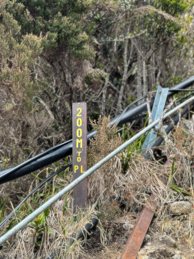
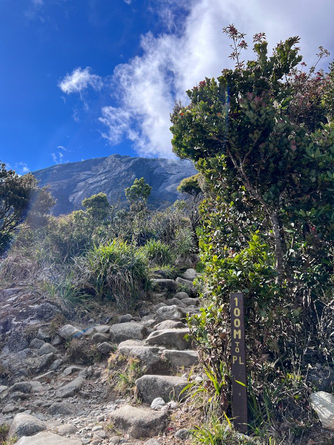
Our final kilometre was a careful, stop-start affair — short stretches, frequent breaks every few metres as the thinner air above 3,000m made the cramps recovery noticeably slower. With less than 1km to go, I pushed faster hoping to get help from base camp but I was spent within minutes. The speed climbing took more out of me than usual and the altitude was not helping. Then, the 200m marker appeared and the legs found a gear they had no business finding. Shortly after, the 100m marker was in sight. These signages worked wonders. Finally, the helipad and red Panalaban sign came around, exactly as I had seen in every photo and somehow still completely surreal when they appeared infront of me.
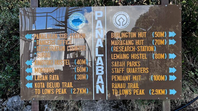
I arrived breathing like I just ran a 200m sprint and climbed up to the Rangers Office. One thing nobody mentions: the entire base camp is built on a hill. Everything is connected by stairs. You have just climbed up 1,400m of elevation and you will continue to climb stairs to get around. The mountain has a sense of humour. The ranger I found grabbed a cold spray without a word and set off. He lost me within seconds once we hit back on trail. No hesitation, no careful footing, he effortlessly hopped down the same steps that I was just struggling to run up. We’re in good hands.
By the time I reached the group he was already there, crouched down, cold spray in hand. We made the ascent back up together with the ranger supporting my friend and the rest of us resuming the pace that worked. Knowing how close we were, that last stretch up felt easier this time. After close to 6hrs on trail, we officially completed our Day 1 ascent and checked in to Panalaban Base Camp at 4pm.
(To be continued in Part 2)
This is part of the Mountain Stories from Our Ultimate Guide to DIY your Mount Kinabalu Trek under S$500.